泊地情報
瀬戸内海
仙酔島
Sensuijima
34 23.100N 133 23.400E
艇を留める位置の詳細は下記Google Mapで航空写真を選択し、拡大
Google Map 男木港→仙酔島
Google Map 仙水島→鞆の浦
航路情報
尾道→仙酔島 2018.9.15
男木港→仙酔島 2013.9.19
仙酔島→鞆の浦
BLOG
仙酔島 へ再びやって来ました 2018.9.15
鞆の浦観光 2018.9.16
ヨットで仙酔島を訪ねる 2013.9.19
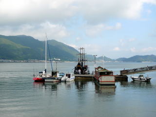
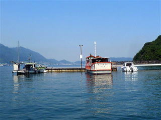
仙酔島港
仙酔島は目的地というより、鞆の浦に行くための泊地と言う位置付けが大きい。
鞆の浦へは着けられないのでここに船を着け、遊覧船で鞆の浦を訪れることになる。
20分おきに遊覧船が来ていて、10分かからない。
係留に当たっては事前に084ー981−5760へ電話してFAX申し込むとの情報あり。(未確認)
私は特に事前許可無く留めました。
泊地情報:
2018.9.15
仙酔島でのヨット係留は、
1)桟橋突堤(横付け)
2)漁船横炊き。この漁船は動いていない様にみえるが、未確認
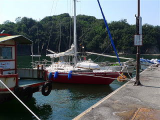
3)観光船第二えびす、海側。2013年に私は槍着け。
(観光船横炊きの場合は船に居る必要あり)
2013.9.19
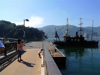
仙酔島へのアプローチ:
仙酔島は鞆の浦入口、北東に位置する。
観光船が着く桟橋があり、その右(南)側に着けられる。
仙酔島桟橋が真北に当たる地点に近づくと黒の玉2つを着けた柱が立っている。
潜岩と思われる。注意。
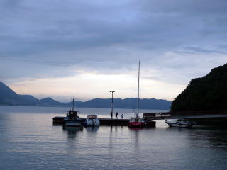
泊地:
桟橋の右(南)側。
周囲の水深は十分ある。
ただ、遊覧船や漁船が既に留まっており、
余地は槍着け1艇しかない。横着けできるスペースは無いので要注意。
トイレ:桟橋そばの公衆トイレ。
コインランドリー:無い。
食品類買物:無い。。
燃料:未確認
食事:無い。ホテル、国民宿舎で可能かもしれない(未確認)
風呂:国民宿舎。525円で、タオル付き。
水:未確認
泊地情報、航路情報一覧に戻る
Sensuijima
google map Ogishima Island→Sensuijima Island
google map Sensuijima Island→Tomonoura
Sept.19.2013
Sensuijima island is not a final destination for me. It is a stopping point
to visit
Tomonoura. I moored my boat here; and then took a tour boat service for
Tomonoura.
Every twenty minutes, the tour boat takes you there for ten minutes.
Sensuijima island is located in the north east of the Tomonoura harbor
entrance.
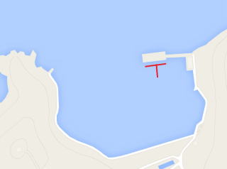
As you see the red “T” sign in the map below,
you may moor your boat at the south side of the pontoon which is used for
the ferry boat.
As the room is not enough because of the ferry and fishing boats,
you will need to put your boat stern-to, not along-side. The water depth
is enough.
When you approach the pontoon from the north, you will see a pole which
has two black balls.
As it must be a mark of submerged rocks, be careful !
Public toilet is near the pontoon.
No shopping, no restaurant, nor coin laundry
A hotel called “Kokumin Shukusha” has a public bath service for JPY525.
| 移動された後の係留状況 2018 | 移動を指示された係留状況 2018 |
| |
|
| 係留状況 | 係留場所 |
|
|
| 2013桟橋空き状況 | 2013桟橋風景 |
| |
|